EDO FIVE HIGHWAYS: The Roads That Built Japan
1.The Origin of Today’s Shinkansen and Expressways Lies in Edo
2. The Five Routes Radiate from Nihonbashi, Ground Zero for the Nation
From this central point, the Five Routes radiated outwards:
- Tokaido Road (Approx. 490 km): The main artery connecting Edo directly to Kyoto.
- Nakasendo Road (Approx. 530 km): This route travels inland, crossing mountains and featuring quiet, established post town landscapes.
- Koshu Kaido Road (Approx. 210 km): A route for military deployment and merchants, leading through Kofu to Suwa.
- Nikko Kaido Road (Approx. 140 km): This road held ceremonial importance as the route of authority leading to Nikko, the site of the mausoleum of Tokugawa Ieyasu, the founder of the Edo Shogunate.
- Oshu Kaido Road (Approx. 80 km): Extending from Utsunomiya north to Shirakawa, it was vital for communication and defense in the northern regions.
Understanding their lengths and functions makes it clear that the Five Routes formed the structural framework of Japan.
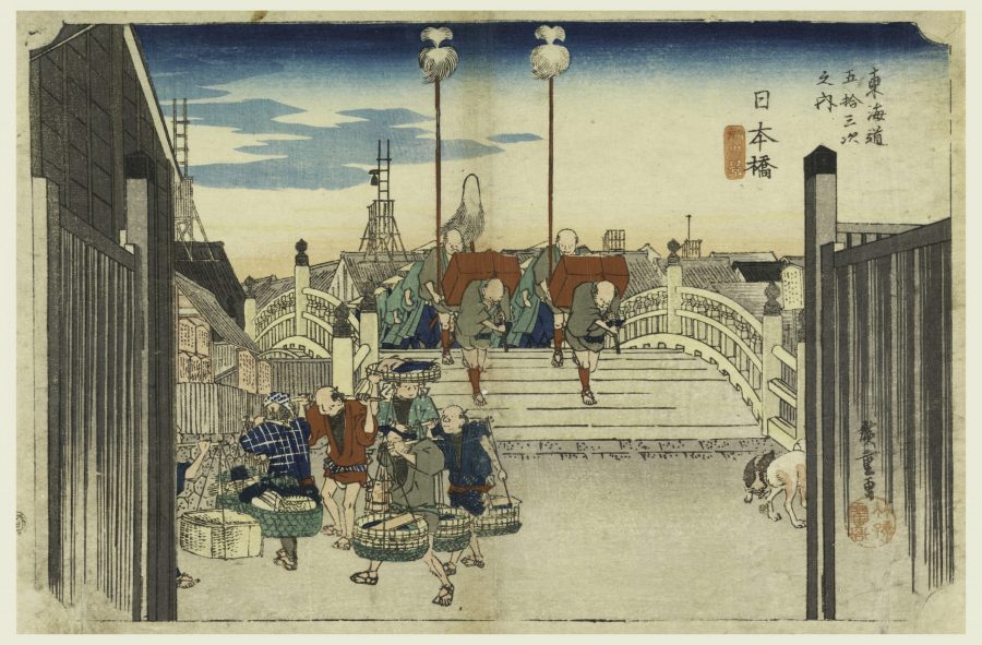
Utagawa Hiroshige 《Fifty-three Stages of the Tokaido Highway: Nihonbashi Station》
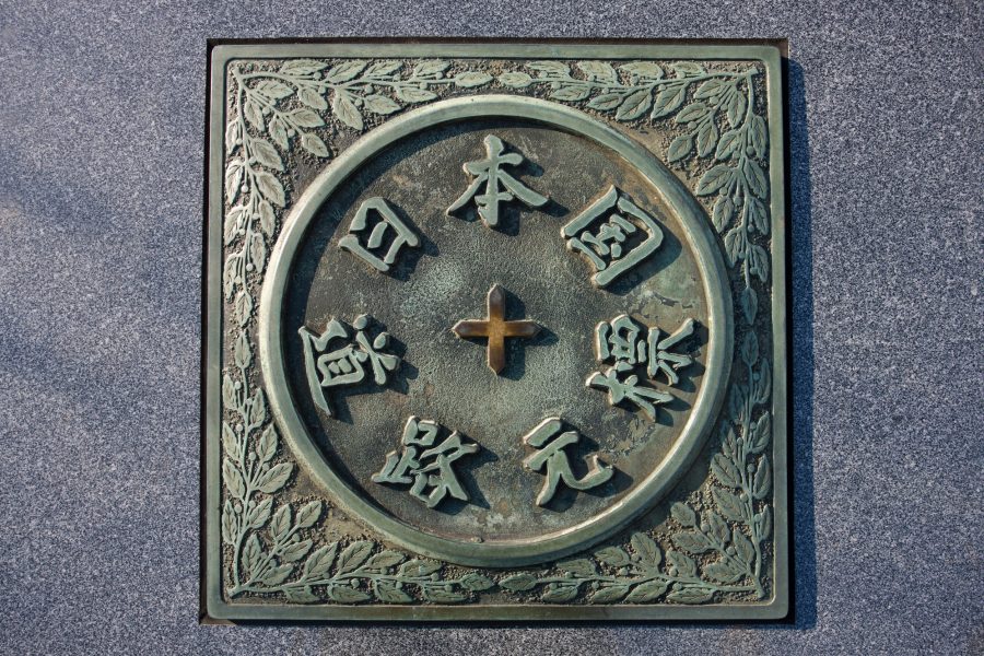
Japan National Highway Kilometer Zero Marker (Tokyo)
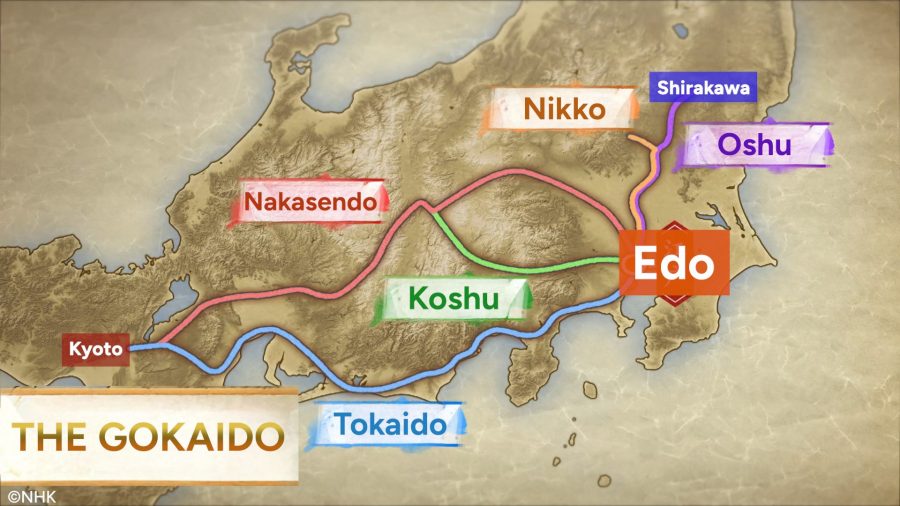
The Five Routes
3.The Integrated Systems Along the Highways
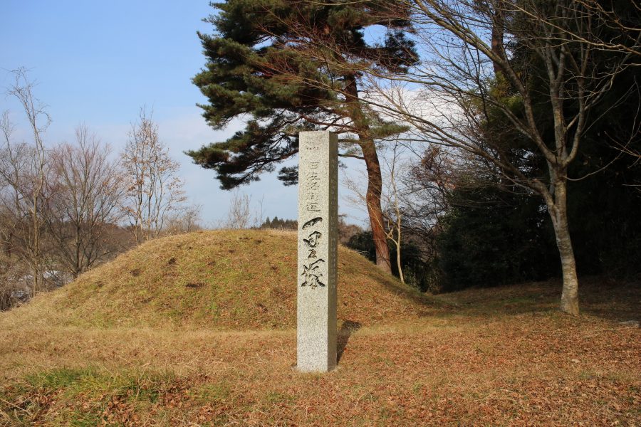
- Ichirizuka (Distance Markers): These landmarks served as reference points for measuring distance and marked rest stops, strategically placed approximately every four kilometers (equivalent to one ri). Constructed as mounds of earth, they were typically adorned with hackberry or pine trees, providing travelers with a reliable means of tracking their journey’s progress throughout the country.
- Shukuba-machi (Post Towns): These acted as supply, lodging, and transport relay points. Besides inns and tea houses, they featured the toiyaba (agency for managing luggage and human/horse transport), the honjin (main lodging for high-ranking officials), and the wakihonjin (secondary lodging). They essentially served as the route’s traffic management centers.
- Sekisho (Checkpoints): These were the control gates of the era. Travelers had to present a travel permit to prove their identity and destination, and their luggage was inspected. This system of permits and cargo control safeguarded the highways and formed an invisible infrastructure that supported a long period of peace.
The shogunate intentionally maintained inconvenience in certain areas. At the Oi-kawa River, a notoriously difficult section of the Tokaido road, building bridges and using ferry boats was strictly prohibited. This restriction effectively turned the river into a natural checkpoint, designed to delay any potential invading forces. As a result, travelers had to rely on specialized porters to carry them across the river.
Semine Distance Marker (Miyagi Prefecture)
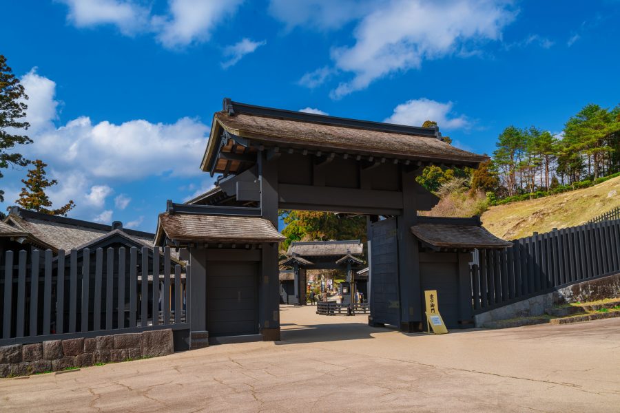
Hakone Sekisho(Checkpoint) (Kanagawa Prefecture)

Utagawa Kunihisa 《Tokaido River: View of the Oi River》
4.The People Who Traveled the Five Routes
A journey on foot from Edo to Kyoto typically took about two weeks. Travelers would walk about eight to ten ri (32–40 km) a day, relying on the ichirizuka to check their progress.
The speed of messengers was astonishing. Records show that official relay messengers could cover the approximately 490 km from Edo to Kyoto in just three to four days. This speed was achieved through a system of courier relays (similar to a modern ekiden race), nighttime shifts, and uniform traffic management rules, ensuring that crucial documents could arrive in as little as three days.
Over time, travel evolved into a popular form of recreation for the common people. Pilgrimages to Ise-jingu Shrine and sightseeing tours became popular, transforming the Five Routes from a “path of movement” to a “path of experience.” Local specialty dishes and scenic spots became travel highlights. Along the roads, a culture of charity spread, with people offering food and lodging to pilgrims, allowing even those who could not afford adequate travel expenses to enjoy the journey.
These routes were also the paths used for Sankin Kotai (Alternate Attendance), the system which required the daimyo of each domain to travel between Edo and their home domain every other year. Post towns became bustling centers of activity whenever a daimyo procession arrived, sometimes involving anywhere from a few hundred to two thousand people. The highways transformed into massive market spaces, catering to everything from porters, horses, meals, bedding, and souvenirs, to tool repairs and performances by entertainers.
The Sankin Kotai system drove the development of infrastructure along the highways, greatly influencing the evolution of transportation, stimulating local economies, and promoting cultural exchange.
5.History You Can Still Walk: Start with One Step
Remnants of the Five Routes remain in many places today: stone pavements, rows of trees, the atmosphere of mountain passes, preserved post town buildings, reconstructed checkpoints, and the sites of former ichirizuka. By walking the highways, you can experience history firsthand.
The best place to start is at ground zero in Nihonbashi. By walking in the footsteps of those who came before us, we can feel the distances and times they experienced. Just take the first step, and the next will surely become a meaningful story of your own.
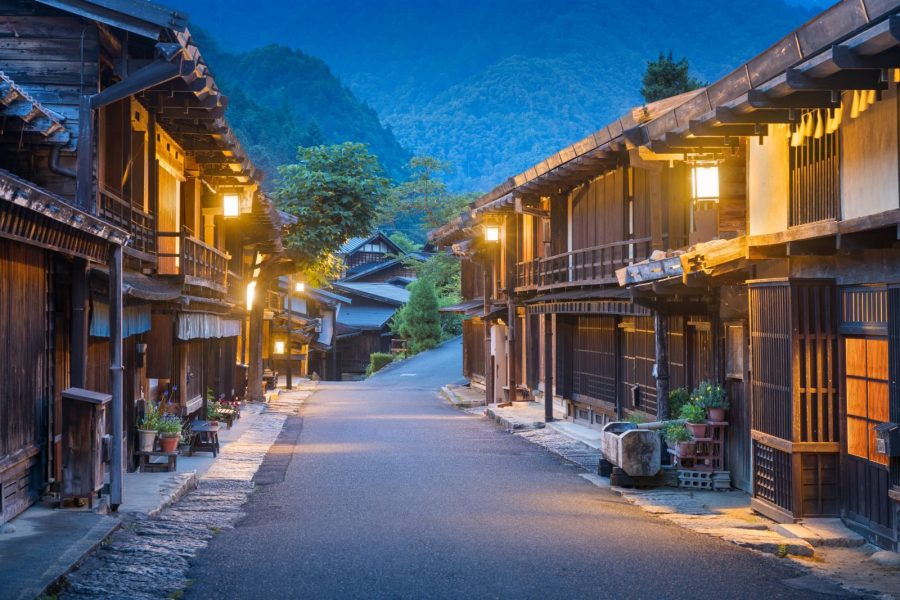
Tsumago-juku (Nagano Prefecture)
Travel Guide
| Spot |
Prefecture
|
|---|---|
| Monument to the Origin of Nihonbashi | Tokyo |
| Milestones(Semine) | Miyagi |
| Tsumago-juku | Nagano |